Samut Sakhon
Samut Sakhon
สมุทรสาคร | |
|---|---|
| City of Samut Sakhon เทศบาลนครสมุทรสาคร | |
 Viewpoint of Samut Sakhon | |
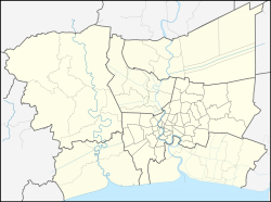
Location in Bangkok Metropolitan Region Location in Thailand | |
| Coordinates: 13°32′55″N 100°16′39″E / 13.54861°N 100.27750°E | |
| Country | |
| Province | |
| District | Mueang Samut Sakhon |
| Government | |
| • Type | City Municipality |
| • Mayor | Supap Saeheng |
| Area | |
• Total | 10.33 km2 (3.99 sq mi) |
| Population (2014) | |
• Total | 60,103 |
| • Density | 5,800/km2 (15,000/sq mi) |
| Time zone | UTC+7 (ICT) |
| Area code | (+66) 34 |
| Website | sakhoncity |
Maeklong Railway | ||||||||||||||||||||||||||||||||||||||||||||||||||||||||||||||||||||||||||||||||||||||||||||||||||||||||||||||||||||||||||||||||||||||||||||||||||||||||||||||||||||||||||||||||||||||||||||||||||||||||||||||||||||||||||||||||||||||||||||||||||||||||||||||||||||||||||
|---|---|---|---|---|---|---|---|---|---|---|---|---|---|---|---|---|---|---|---|---|---|---|---|---|---|---|---|---|---|---|---|---|---|---|---|---|---|---|---|---|---|---|---|---|---|---|---|---|---|---|---|---|---|---|---|---|---|---|---|---|---|---|---|---|---|---|---|---|---|---|---|---|---|---|---|---|---|---|---|---|---|---|---|---|---|---|---|---|---|---|---|---|---|---|---|---|---|---|---|---|---|---|---|---|---|---|---|---|---|---|---|---|---|---|---|---|---|---|---|---|---|---|---|---|---|---|---|---|---|---|---|---|---|---|---|---|---|---|---|---|---|---|---|---|---|---|---|---|---|---|---|---|---|---|---|---|---|---|---|---|---|---|---|---|---|---|---|---|---|---|---|---|---|---|---|---|---|---|---|---|---|---|---|---|---|---|---|---|---|---|---|---|---|---|---|---|---|---|---|---|---|---|---|---|---|---|---|---|---|---|---|---|---|---|---|---|---|---|---|---|---|---|---|---|---|---|---|---|---|---|---|---|---|---|---|---|---|---|---|---|---|---|---|---|---|---|---|---|---|---|---|---|---|---|---|---|---|---|---|---|---|---|---|---|---|---|
| ||||||||||||||||||||||||||||||||||||||||||||||||||||||||||||||||||||||||||||||||||||||||||||||||||||||||||||||||||||||||||||||||||||||||||||||||||||||||||||||||||||||||||||||||||||||||||||||||||||||||||||||||||||||||||||||||||||||||||||||||||||||||||||||||||||||||||
Samut Sakhon (Thai: สมุทรสาคร, pronounced [samùt sǎːkʰɔːn], Pronunciation) is a city in Thailand; it is the capital of Samut Sakhon province.[1] It is a stop on the Maeklong Railway. Samut Sakhon is 48 km from Bangkok.[2] It is part of the Bangkok Metropolitan Region.
Name
[edit]Samut Sakhon was formerly called Tha Chin (Chinese Pier) probably because, in the old days, it had been a trading port for a vast number of Chinese junks. In 1548, a city named Sakhon Buri was established at the mouth of the Tha Chin River. It was a center for recruiting troops from various seaside towns. The name of the city was changed to Mahachai when Khlong (canal) Mahachai was dug in 1704 to connect the Tha Chin River to the city. Later, the city was renamed Samut Sakhon by King Rama IV but it is still popularly called Mahachai by its residents.[1]
References
[edit]- ^ a b "Samut Sakhon". Tourist Authority of Thailand (TAT). Archived from the original on 28 May 2015. Retrieved 28 May 2015.
- ^ "Distance: Bangkok to Samut Sakhon". Google Maps. Retrieved 28 May 2015.
External links
[edit]- Official website
 Samut Sakhon travel guide from Wikivoyage


